


Geomarine Systems Limited (GSL) is an indigenous Nigerian multidisciplinary geoscience company headquartered in Port Harcourt, Rivers State. Established in 1988 according to its company profile, the organisation provides specialised geophysical, geotechnical, hydrographic, marine surveying, seismic data acquisition, navigation, positioning, and engineering investigation services.
The company supports organisations involved in oil and gas exploration and production, offshore engineering, marine construction, pipeline development, infrastructure projects, and environmental investigations.
Geomarine Systems Limited combines technical personnel, specialist survey equipment, geoscience expertise, and data acquisition and processing capabilities to investigate land, seabed, riverbed, lakebed, and subsurface conditions. Its work helps clients obtain relevant technical information for exploration planning, engineering design, construction, offshore development, and asset-related decision-making.
The company’s published service portfolio includes:
- Seismic data acquisition and seismic geophysics.
- Seismic data acquisition quality assurance and quality control (QA/QC).
- Seabed geophysics and marine geophysical surveys.
- Hydrographic surveying and bathymetry.
- Geotechnical engineering and site investigations.
- Land and marine geo-hazard surveys.
- Pipeline route surveys and positioning.
- Survey navigation and positioning.
- Remotely Operated Vehicle (ROV) and Autonomous Underwater Vehicle (AUV) surveys.
- Metocean services.
- Hydrodynamic investigations using Acoustic Doppler Current Profiler (ADCP) systems.
- Electrical resistivity and thermal conductivity surveys.
- Survey data acquisition, processing, interpretation, mapping, and reporting.
Geomarine Systems Limited emphasises technical competence, quality service, integrity, continuous training, environmental sustainability, and the use of appropriate technology. It also highlights its commitment to Nigerian Local Content, with a policy of giving priority to opportunities that maximise Nigerian participation in its projects.
2. Services Offered by Geomarine Systems Limited
A. Seismic Data Acquisition Services
Seismic data acquisition is a geophysical technique used to investigate underground geological structures by generating and recording seismic waves. The resulting information helps geoscientists understand subsurface formations and evaluate geological conditions relevant to oil and gas exploration and other engineering applications.
Geomarine Systems Limited identifies seismic exploration as one of its core capabilities, with experience and stated specialisation covering land, swamp, transition-zone, and offshore environments.
The company describes capabilities in 2D, 3D, and 4D seismic exploration. These approaches provide different levels of subsurface information depending on the survey objectives, project requirements, and acquisition design.
Its seismic data acquisition services can support:
- Land seismic surveys for subsurface geological investigations.
- Swamp and transition-zone seismic data acquisition.
- Offshore and shallow-water seismic survey operations.
- 2D seismic surveys for geological structure assessment.
- 3D seismic surveys for detailed subsurface imaging.
- 4D seismic monitoring applications where repeat surveys are required.
- Seismic acquisition planning and field operations.
- Data collection using appropriate seismic survey equipment.
- Field data quality monitoring and operational reporting.
Seismic data is important to exploration and development companies because it provides information that can support geological interpretation, prospect evaluation, and decisions about where further exploration or drilling may be appropriate.
The exact acquisition methods, equipment configuration, survey coverage, and deliverables depend on the project specification.
B. Seismic Geophysics and Subsurface Investigation
Seismic geophysics uses the behaviour of seismic waves to investigate the physical properties and structure of the ground beneath the surface.
Geomarine Systems Limited provides seismic geophysics services for oil and gas exploration and engineering investigations. Its published capabilities also include shallow seismic investigations for foundation studies.
These services can help clients understand subsurface conditions before undertaking drilling, construction, or other ground-related activities.
Relevant applications include:
- Investigation of subsurface geological structures.
- Seismic data acquisition for exploration projects.
- Shallow seismic investigations for foundation engineering.
- Seismic refraction surveys.
- Multi-Channel Analysis of Surface Waves (MASW).
- Assessment of subsurface conditions relevant to infrastructure projects.
- Collection and processing of seismic information.
- Provision of geophysical data for engineering and geological interpretation.
Seismic refraction and MASW are particularly relevant to near-surface investigations because they can provide information about subsurface layering and ground properties that may influence foundation and construction decisions.
C. Seismic Data Acquisition QA/QC Services
Quality assurance and quality control are important in seismic data acquisition because the reliability of the final interpretation depends significantly on the quality of the information collected in the field.
Geomarine Systems Limited identifies seismic data acquisition QA/QC as a dedicated service. This involves applying appropriate checks and monitoring procedures to assess whether acquired data meets the technical and operational requirements established for a survey.
Depending on the project scope, QA/QC activities may include:
- Monitoring seismic data acquisition procedures.
- Checking field data for completeness and consistency.
- Reviewing acquisition parameters against project specifications.
- Identifying potential data-quality issues during field operations.
- Supporting the investigation of acquisition errors and irregularities.
- Monitoring compliance with agreed technical procedures.
- Providing quality-control observations and reports.
- Supporting the delivery of usable and reliable seismic datasets.
Effective QA/QC can help clients identify data problems early, reduce avoidable rework, and improve confidence in the information used for geological and engineering decisions.
The specific quality-control standards, acceptance criteria, and reporting procedures should be agreed with the client before the commencement of each project.
D. Seabed Geophysics Services
Seabed geophysics involves the use of specialised marine survey equipment and geophysical techniques to investigate the seabed, identify underwater features, and assess conditions that may affect offshore infrastructure and construction.
Geomarine Systems Limited identifies seabed geophysics as one of its major service areas. Its published capabilities cover investigations of underwater structures, seabed conditions, and potential hazards relevant to offshore pipelines, platforms, and jacket installations.
These services are important for offshore oil and gas developments, marine engineering, subsea infrastructure, and pipeline installation projects.
Relevant activities include:
- Seabed geophysical data acquisition.
- Investigation of underwater geological and physical features.
- Mapping of seabed conditions along proposed development areas.
- Identification of potential seabed obstructions and hazards.
- Investigation of seabed characteristics relevant to pipeline routes.
- Survey support for proposed offshore platform and jacket locations.
- Collection of information to support offshore engineering design.
- Processing and presentation of seabed geophysical data.
The company lists specialised equipment such as side-scan sonar, marine magnetometers, and sub-bottom profiling systems among its equipment and systems.
These instruments can help survey teams investigate seabed features, identify potential objects or anomalies, and obtain information about shallow subsurface layers.
E. Hydrographic Surveying and Bathymetric Services
Hydrographic surveying involves measuring and mapping underwater environments, including water depths, seabed features, and other physical characteristics of rivers, lakes, coastal areas, and offshore locations.
Bathymetry focuses particularly on measuring water depths and representing the underwater terrain.
Geomarine Systems Limited identifies hydrography and bathymetry among its core capabilities. These services support offshore engineering, marine construction, dredging, pipeline installation, port development, and other projects that require reliable underwater information.
The company’s published equipment includes single-beam and multibeam echo-sounding systems.
Its hydrographic and bathymetric services can support:
- Single-beam bathymetric surveys.
- Multibeam bathymetric surveys.
- Water-depth measurement and mapping.
- Seabed profiling and mapping.
- Riverbed and lakebed investigations.
- Offshore and nearshore hydrographic surveys.
- Identification of underwater features and obstructions.
- Dredging-related surveys and seabed monitoring.
- Survey support for pipeline and marine infrastructure projects.
- Preparation of bathymetric charts, maps, and digital survey outputs.
Single-beam echo sounders measure water depth along individual survey lines, while multibeam echo sounders collect multiple depth measurements across a wider swath of the seabed.
These techniques can provide useful information for engineering design, navigation-related assessments, dredging planning, and the evaluation of marine project sites.
F. Geotechnical Engineering and Site Investigation
Geotechnical engineering involves the study of soil, rock, sediments, and subsurface conditions to determine how the ground may behave under construction loads and other engineering activities.
Geomarine Systems Limited provides geotechnical engineering and survey services for both land-based and offshore projects. Its official website describes investigations of soil, rock, and underground conditions to support safe and stable foundations for construction and infrastructure development.
The company also identifies geotechnical rigs and geotechnical investigation equipment among its technical resources.
Depending on the project requirements, geotechnical services may include:
- Land-based geotechnical site investigations.
- Marine and offshore geotechnical investigations.
- Soil and sediment investigations.
- Geotechnical boring and sampling.
- Cone Penetration Testing (CPT), where specified and available.
- Investigation of ground conditions for foundation design.
- Geotechnical support for pipeline and infrastructure projects.
- Assessment of soil characteristics relevant to construction.
- Collection and presentation of geotechnical data.
- Technical reporting for engineering and design teams.
Geotechnical investigations help project engineers understand ground conditions and assess potential challenges associated with foundations, offshore structures, pipelines, and other infrastructure.
The specific field-testing methods, sampling procedures, laboratory testing requirements, and reporting standards should be confirmed for each assignment.
G. Marine and Land Geo-Hazard Surveys
Geo-hazard surveys investigate natural or physical conditions that may create risks for engineering, construction, drilling, pipeline installation, or other infrastructure activities.
Geomarine Systems Limited lists land and marine geo-hazard surveys among its capabilities. These investigations are particularly relevant to offshore and nearshore oil and gas projects, where seabed and subsurface conditions can influence the safety and suitability of proposed installations.
Potential survey objectives include:
- Identification of seabed features that may affect offshore construction.
- Investigation of shallow subsurface conditions.
- Identification of potential geophysical anomalies.
- Assessment of possible geological or seabed-related hazards.
- Investigation of riverbed and lakebed conditions.
- Surveying proposed pipeline and offshore development routes.
- Providing geophysical information for engineering risk assessment.
- Supporting site selection and project planning.
Geo-hazard survey information can help operators and engineering contractors identify potential constraints before committing to drilling, construction, or installation activities.
The actual hazards investigated and the survey methods used depend on the project location, technical specification, and operating environment.
H. Offshore and Onshore Pipeline Route Surveys
Pipeline route surveys provide technical information about the proposed or existing route of a pipeline. These surveys are important for identifying terrain conditions, seabed characteristics, potential obstacles, and other factors that could influence pipeline design, installation, and operation.
Geomarine Systems Limited identifies offshore and land pipeline route surveys as part of its geoscience capabilities.
Its pipeline survey-related services can support:
- Preliminary pipeline route investigations.
- Onshore pipeline corridor surveys.
- Offshore and nearshore pipeline route surveys.
- Hydrographic and bathymetric investigations along marine routes.
- Seabed geophysical surveys.
- Geotechnical investigations along proposed routes.
- Identification of route constraints and potential hazards.
- Positioning support for pipeline survey operations.
- Survey information for pipeline engineering and installation planning.
- Mapping and reporting of acquired route data.
These services can support oil and gas operators, pipeline contractors, engineering consultants, and organisations undertaking energy infrastructure projects.
The required survey coverage, accuracy, investigation methods, and deliverables should be established according to the pipeline design and project requirements.
I. Survey Navigation and Positioning Services
Navigation and positioning services provide accurate location information for survey vessels, equipment, underwater systems, and land-based survey activities.
Geomarine Systems Limited identifies survey navigation and positioning as a core service. These capabilities are important in marine and offshore operations where precise positioning is required for data acquisition, route mapping, engineering surveys, and installation support.
The company’s positioning and navigation services can support:
- Marine survey navigation.
- Positioning for hydrographic data acquisition.
- Land survey positioning.
- Geospatial data collection.
- Positioning support for offshore investigations.
- Survey vessel navigation and line keeping.
- Positioning of survey equipment and sensors.
- Location referencing for marine and land project data.
- Integration of positioning information with survey datasets.
The company lists a Hypack navigation system and a Hemisphere heading sensor among its equipment and systems.
Accurate navigation and positioning help ensure that collected survey data is properly referenced to the intended geographic locations and can be used effectively for mapping, analysis, and engineering purposes.
J. ROV and AUV Survey Services
Remotely Operated Vehicles (ROVs) and Autonomous Underwater Vehicles (AUVs) are specialised underwater systems used to collect information from locations that may be difficult or impractical to investigate using conventional survey methods.
Geomarine Systems Limited identifies ROV and AUV surveys among its current service offerings. Its website describes the use of these technologies to access hard-to-reach areas and improve underwater survey data acquisition.
These technologies can support offshore infrastructure investigations, subsea surveys, and underwater mapping.
Depending on the equipment configuration and project requirements, ROV and AUV survey applications may include:
- Underwater visual survey support.
- Investigation of subsea structures and facilities.
- Surveying underwater features and seabed conditions.
- Collection of underwater imagery and sensor data.
- Inspection support for selected subsea assets.
- Investigation of hard-to-reach marine environments.
- Data acquisition for subsea engineering and assessment.
- Integration of underwater survey information with positioning systems.
ROVs are generally controlled remotely by operators, while AUVs are designed to undertake programmed underwater missions with varying levels of autonomy.
The exact vehicle class, sensor configuration, operating depth, inspection capability, and availability should be confirmed with the company for each project.
K. Metocean Services
Metocean services involve the collection and analysis of meteorological and oceanographic information relevant to marine and offshore operations.
Metocean information can be important in planning offshore construction, marine transportation, subsea installation, and other activities affected by environmental conditions.
Geomarine Systems Limited lists metocean services among its capabilities.
Depending on the scope of the assignment, metocean-related investigations may support:
- Assessment of marine environmental conditions.
- Collection of relevant oceanographic information.
- Investigation of water movement and related marine parameters.
- Support for offshore engineering and marine project planning.
- Environmental data collection for project assessment.
- Provision of information relevant to marine operational planning.
The exact parameters measured, monitoring duration, equipment, and reporting deliverables should be confirmed with the company.
L. Hydrodynamic Studies and ADCP Services
Hydrodynamics examines the movement and behaviour of water under different environmental and physical conditions.
An Acoustic Doppler Current Profiler (ADCP) is an instrument used to measure water-current velocities at different depths. It can provide useful information about current profiles and water movement in rivers, estuaries, coastal waters, and offshore environments.
Geomarine Systems Limited identifies hydrodynamic investigations using ADCP systems among its technical capabilities.
These services may support:
- Measurement of water-current velocities.
- Investigation of current profiles at different water depths.
- Hydrodynamic data acquisition in marine environments.
- Studies of river and estuarine water movement.
- Collection of current information for marine engineering.
- Support for offshore and coastal project planning.
- Environmental and engineering investigations requiring water-flow data.
Hydrodynamic information can assist engineers in evaluating water movement around proposed structures, pipelines, marine facilities, and other developments.
The scope of any ADCP assignment should specify the measurement location, duration, deployment method, data requirements, and reporting format.
M. Electrical Resistivity Surveys
Electrical resistivity surveying is a geophysical investigation method that measures how strongly subsurface materials resist the flow of electrical current.
Different soil, rock, groundwater, and geological conditions can produce different electrical-resistivity responses. These measurements can therefore help investigate subsurface characteristics without relying exclusively on intrusive methods.
Geomarine Systems Limited lists electrical resistivity surveys among its capabilities.
Potential applications include:
- Near-surface geophysical investigations.
- Assessment of subsurface variations.
- Investigation of geological structures.
- Ground-condition assessment for engineering projects.
- Support for selected environmental and infrastructure investigations.
- Collection and interpretation of electrical-resistivity data.
The specific survey arrangement, electrode configuration, depth of investigation, and interpretation objectives depend on the project.
N. Thermal Conductivity Surveys
Thermal conductivity describes the ability of a material to conduct heat. Measuring this property can be relevant to engineering applications where heat transfer through soil, sediment, or other materials needs to be understood.
Geomarine Systems Limited identifies thermal conductivity surveys among its geophysical capabilities.
Depending on the project requirements, thermal conductivity investigations may support:
- Assessment of the thermal properties of soil or sediment.
- Collection of data for engineering studies.
- Investigations relevant to underground and buried infrastructure.
- Technical assessment of ground conditions where heat transfer is an important design consideration.
Clients should confirm the specific measurement methods, equipment, sample requirements, and deliverables available for their project.
O. Survey Equipment and Geophysical Systems
Geomarine Systems Limited highlights specialised equipment and systems used to support its marine, geophysical, and geotechnical operations.
Its published equipment list includes:
- Side Scan Sonar – C-Max: Used to produce acoustic images of the seabed and identify underwater objects and features.
- Marine Magnetometer G882: Used to detect variations in the magnetic field that may help identify ferrous objects and geological features.
- Innomar Compact 2000 Sub-bottom Profiler: Used to investigate shallow subsurface sediment layers beneath the seabed.
- DMS-05 Motion Compensator: Used to account for vessel movement in relevant survey applications.
- Odom MK III E Marine Echo Sounder: Used for marine depth measurement.
- GeoAcoustics GS 4 Multibeam Echo Sounder: Used to acquire multibeam bathymetric data.
- Hemisphere Heading Sensor: Used to provide heading information for positioning and navigation.
- Geotechnical Rig: Used for specified geotechnical field investigation activities.
- Hypack Navigation System: Used for hydrographic survey planning, navigation, and data acquisition workflows.
The company’s website also refers to modern survey technologies, AI-enabled LiDAR systems, multibeam echo sounders, neural networks, and imaging software for selected survey and facility-imaging applications.
Actual equipment availability and configuration should be confirmed for each contract.
P. Survey Data Acquisition, Processing, Mapping, and Reporting
Survey data must be collected, checked, processed, and presented in a form that clients and engineering teams can use.
Geomarine Systems Limited identifies data acquisition and processing as important parts of its service capabilities.
Its data-related services can support:
- Field data acquisition.
- Geophysical and geotechnical data organisation.
- Seismic data quality checks.
- Hydrographic and bathymetric data processing.
- Survey navigation and positioning data integration.
- Geospatial mapping and presentation.
- Preparation of charts and survey outputs.
- Technical data interpretation within the agreed scope.
- Preparation of reports for engineering and project teams.
Reliable data processing and reporting help clients understand survey findings, evaluate site conditions, and incorporate technical information into engineering design and project planning.
The final deliverables, data formats, coordinate systems, software requirements, and quality-control procedures should be agreed with the client before work begins.
3. Industries and Sectors Served
Geomarine Systems Limited’s multidisciplinary capabilities are relevant to a variety of industries that depend on accurate geoscience information, engineering investigations, and marine survey services.
Oil and Gas Exploration and Production
Seismic acquisition, seabed geophysics, geotechnical investigations, and pipeline route surveys can support exploration planning, offshore development, and oil and gas infrastructure projects.
Offshore Engineering and Construction
Hydrographic, geophysical, positioning, and geotechnical services can support offshore platform development, subsea infrastructure, and marine installation activities.
Marine and Maritime Industry
Bathymetry, navigation, positioning, seabed investigations, and metocean services can support marine infrastructure and vessel-related project requirements.
Pipeline and Energy Infrastructure
Pipeline route surveys, geotechnical investigations, and geo-hazard assessments can support the planning and development of onshore and offshore pipeline infrastructure.
Civil Engineering and Construction
Geotechnical and shallow seismic investigations can provide information about soil, rock, and subsurface conditions relevant to foundation design and infrastructure construction.
Dredging and Waterway Development
Hydrographic and bathymetric surveys can support dredging planning, seabed assessment, and waterway development projects.
Environmental and Geoscience Investigations
Geophysical, hydrodynamic, and other survey methods can support investigations requiring information about ground, seabed, and water conditions.
Telecommunications and Subsea Infrastructure
Marine survey and positioning capabilities can be relevant to subsea cable routes and other underwater infrastructure projects.
4. Company Commitment to Quality, Safety, and Professional Service
Geomarine Systems Limited presents its business philosophy around integrity, human development, environmental sustainability, quality service, innovation, and continuous training.
Commitment to Quality Service
The company identifies quality service as one of its core principles. It emphasises attention to detail, continuous improvement, and the delivery of services intended to meet client requirements.
For geoscience and engineering projects, quality depends on appropriate survey methods, suitable equipment, competent personnel, reliable data acquisition, and careful processing and reporting.
GSL’s published service portfolio reflects a focus on providing technical information that can support engineering and operational decisions.
Commitment to Health and Safety
Geophysical, marine, geotechnical, and offshore operations can involve demanding field conditions and technical risks. GSL’s stated vision highlights a culture of continuous training, precision, and commitment to safety.
The company’s mission also refers to delivering services with safety as an important consideration.
For each project, the appropriate safety arrangements should reflect the operating environment, equipment, personnel, client procedures, and applicable statutory requirements.
Commitment to Environmental Sustainability
Geomarine Systems Limited identifies environmental sustainability as a core value. The company states that it prioritises environmental stewardship in business decisions and seeks to minimise its ecological footprint while preserving natural resources.
This is particularly relevant to marine and geoscience projects, where survey activities may take place in coastal, offshore, riverine, swamp, and other environmentally sensitive locations.
Its environmental focus supports responsible planning and execution of technical investigations in line with applicable project and regulatory requirements.
Commitment to Integrity and Professional Ethics
The company identifies integrity as a fundamental business principle. It describes its approach as being based on honesty, accountability, and actions that build confidence among stakeholders.
Professional integrity is important in technical surveying because clients rely on accurate data, transparent reporting, and responsible communication of project findings.
Commitment to Human Development and Training
Geomarine Systems Limited states that it continues to invest in personnel training at different levels.
The company recognises that modern equipment and technology deliver value when operated by appropriately trained and competent personnel.
Its published training approach includes workplace learning, field training, on-the-job development, engagement with equipment manufacturers, and continuous exposure to evolving technical knowledge.
This commitment supports the development of Nigerian geoscience and marine survey expertise.
Commitment to Nigerian Local Content
The company states that it is committed to implementing the Nigerian Local Content Act in its operations.
It describes a policy of giving first consideration to strategies and options that maximise Nigerian input into projects, including materials, technology, and personnel.
This commitment reflects an emphasis on indigenous participation, local technical capacity, and the development of Nigerian expertise within the oil and gas and engineering sectors.
Commitment to Innovation and Technology
Geomarine Systems Limited highlights its use of advanced survey equipment and its interest in emerging technologies.
Its published capabilities include specialist sonar systems, sub-bottom profilers, multibeam echo sounders, geotechnical equipment, positioning systems, ROV and AUV surveys, and newer imaging and data-processing technologies.
The company also emphasises continuous training and the adoption of evolving technical knowledge to maintain relevant capabilities.
Commitment to Client Satisfaction
The company states that it aims to deliver reliable technical solutions and provide value through quality service and continuous improvement.
Its multidisciplinary service offering can help clients coordinate different geoscience and engineering investigations within a broader project programme.
Clear communication, agreed technical specifications, appropriate planning, and timely reporting are important parts of a successful client relationship.
5. Why Choose Geomarine Systems Limited?
Organisations seeking geoscience, marine surveying, and engineering investigation services may consider Geomarine Systems Limited for the following reasons:
Multidisciplinary technical capability: Its published portfolio covers seismic geophysics, seabed investigations, hydrography, bathymetry, geotechnical engineering, positioning, and other specialist survey services.
Experience in the Nigerian operating environment: The company describes experience across the Niger Delta, northern regions of Nigeria, and offshore environments, with personnel who have also worked in international locations.
Specialised survey equipment: Its published equipment list includes sonar systems, sub-bottom profilers, multibeam echo sounders, geotechnical rigs, and navigation systems.
Land and marine project support: Its capabilities address both land-based and offshore investigations, including swamp and transition-zone seismic environments.
Commitment to Nigerian Local Content: The company emphasises maximising Nigerian participation in its projects through personnel, materials, and technology.
Continuous personnel development: The company identifies training and technical development as important to the effective use of modern equipment and systems.
Quality, integrity, and environmental responsibility: These principles form part of the company’s stated values and operating philosophy.
Broad industry relevance: Its technical services are applicable to oil and gas exploration, offshore infrastructure, marine construction, pipeline development, dredging, and civil engineering.
6. Selected Projects and Industry Experience
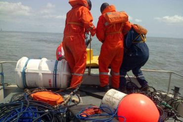
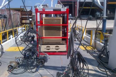
The company’s official website publishes examples of completed projects and technical assignments, including:
- Geotechnical work for the NNPC G-791 Gas Pipeline Project.
- Marine geotechnical and geophysical services for Chevron Nigeria Limited.
- Geophysical sensor deployment for a Conoil/Belbop survey.
- Dredge scour observations on an estuarine seabed using a GeoAcoustics GeoSwathe GS4 wideswath bathymetry system.
- UAV LiDAR survey in the Ibaka area of Akwa Ibom State.
- Seismic shot-hole drilling.
- Geotechnical boring in the Lagos Lagoon for Oando Plc.
- Shallow marine 3D seismic survey data acquisition.
- Operation of a CPT rig during ALSCON geophysical survey work.
- Side-scan sonar imagery showing a sunken boat.
- Marine geophysical survey of the Imo River, including pipeline trench observations.
- Geotechnical boring in the Imo River for ALSCON/MTS.
These examples are presented on the company’s website as project references. Prospective clients should contact GSL for further information about project scope, dates, references, and relevant experience.
7. Company Commitment Statement
Geomarine Systems Limited is committed to providing professional geoscience, geophysical, geotechnical, hydrographic, and marine surveying services that support informed decision-making across the oil and gas, offshore engineering, construction, infrastructure, and environmental sectors.
The company places emphasis on quality service, technical precision, integrity, environmental sustainability, personnel development, and the responsible use of modern technology.
Through its seismic data acquisition, seabed geophysics, hydrographic surveying, bathymetric mapping, geotechnical investigations, positioning, and underwater survey capabilities, Geomarine Systems Limited seeks to provide clients with reliable technical information for exploration, engineering design, project planning, and infrastructure development.
Its commitment to Nigerian Local Content and continuous professional development further reflects its objective of strengthening indigenous technical capacity while delivering services that respond to the evolving requirements of the Nigerian and international geoscience industries.
Contact Business
Opening Hours
Additional info

Los Anegles
Los Anegles
